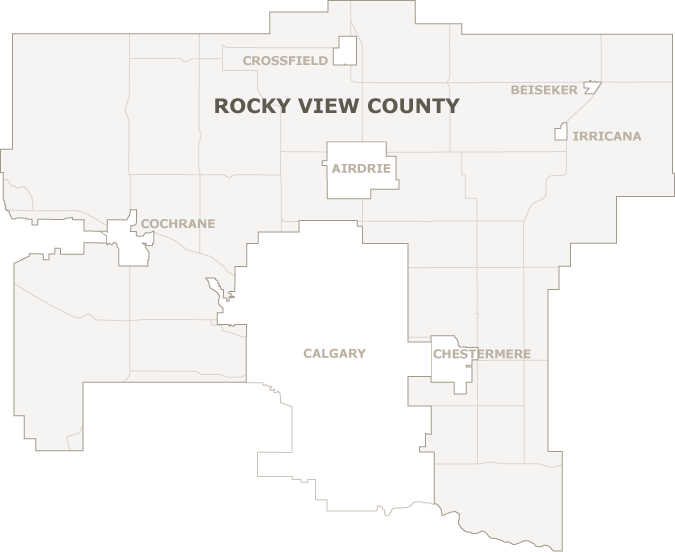
Rocky View is located in the southern portion of Alberta in the western portion of Canada. The County surrounds the City of Calgary in a horseshoe-shape to the west, north and east.

Detailed Rocky View County Map (PDF)
Rocky View is approximately three hours south of Alberta’s capital city, Edmonton, one hour from the Town of Banff in the Rocky Mountains and three and a half hours north of the United States border in the State of Montana.
- Elevation:
1,048.43 meters or 3,439.71 feet above sea level. Elevation varies within Rocky View County.
- Latitude:
51º 03’ 07” N
- Longitude:
114º 22’ 14” W
- Time Zone:
Mountain Standard Time (MST)
- Area:
393,463 hectares or 972,264 acres (approximately 42 townships)
- Hours of sunshine per year:
2,405+
- Average daily max summer temperature:
21ºC
- Average daily max winter temperature:
-0.4ºC